With 100,000 homes in Hull and the East Riding at risk of flooding our ambition is to invest in blue green infrastructure schemes to increase surface water flood resilience.
In delivering the Living with Water schemes, we aim to involve residents and communities in what the flood schemes may look like. This project is modelling a range of sustainable drainage solutions (SuDS) in Bilton to reduce the likelihood of flooding in the future. SuDS aim to mimic natural drainage by slowing and capturing the water flow and holding excess water during a heavy rainfall event.
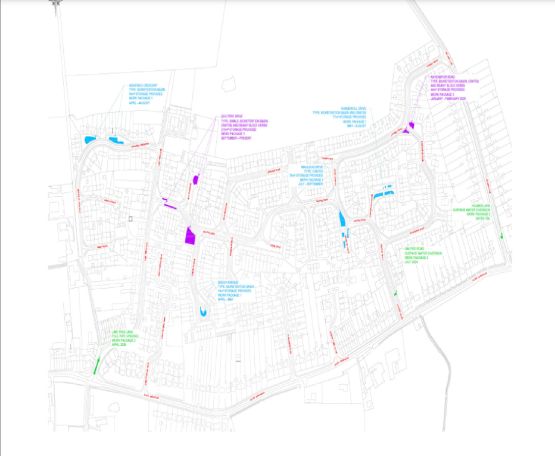
Bilton SuDS
Bilton was one area badly affected by flooding in 2007. Surface water ran off surrounding land and quickly filled the watercourses and sewers and ponding in low spots in the area. In many cases house threshold levels are lower than adjacent roads or open spaces and therefore this was where flooding of property and roads occurred.
Unfortunately, because of the regions topography, once water is in the watercourses and sewers it has little velocity in terms of flow. This means that even in flood situations, water is not moving quickly through the system to discharge and therefore backing up of systems and localised ponding occurs. Even if new “super” sewers were constructed, which would likely involve significant disruption, there would still be an issue with a lack of gravity to enable water to flow. The lack of flow was the deciding factor in the case for filling in watercourses which previously conveyed water through the city. They were a lot of issues with stagnation, pollution and odour. Therefore retrofitting SuDS to manage the flood risk, alongside improving the water quality, habitat and green spaces is a preferable option.
These schemes are designed to slow the flow of surface water into the existing watercourse and sewer system from the surrounding areas around the region, but there is still excess flows from rainfall directly onto localised areas which needs to be managed. This is what the principle of the SuDS retrofits are. Its providing that storage for the water in created, managed areas so that excess flows are channelled to these areas rather than into properties or infrastructure.
Through consultation with residents from October 2023 to March 2024, we have designed schemes that reflect the village, are safe and mitigate surface water flood risk.
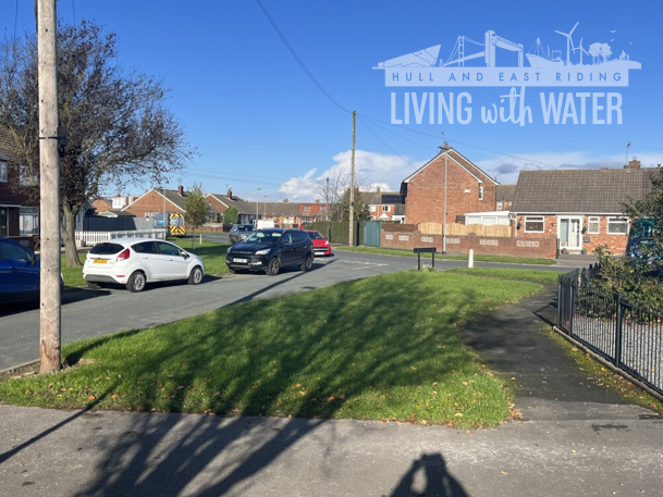
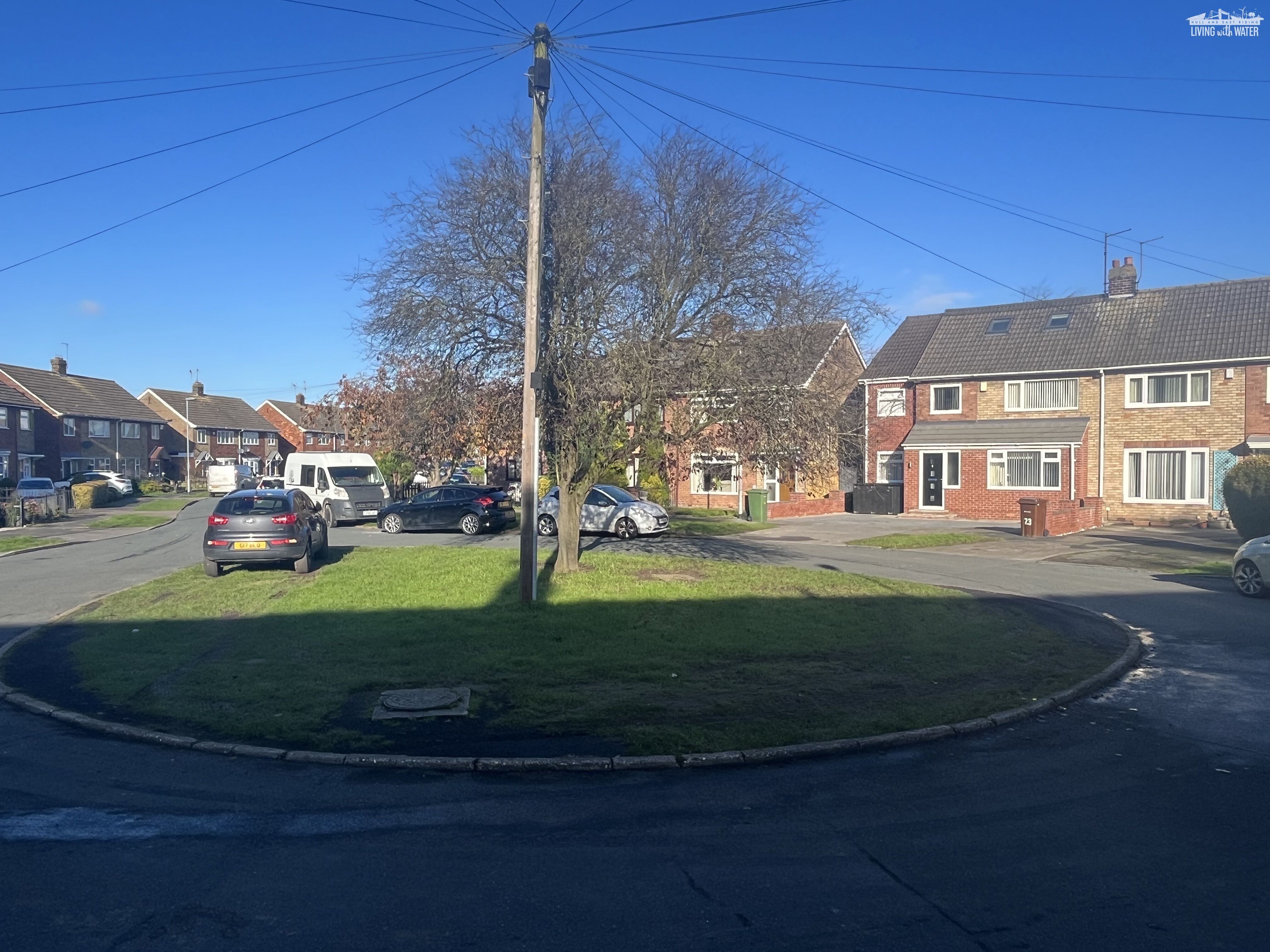
From 25th March 2024, we’ll be carrying out flood protection work by creating sustainable drainage systems (SuDS) in and around some of the green spaces in the village. Schemes in this location have been hydrologically modelled to give greatest benefit to the village.
Morrison Water Services will be carrying out this work on our behalf and their working days are Monday to Friday 8am – 5pm.
Please be assured that every care will be taken by our Contractor and your co-operation is greatly appreciated. All staff will have identification with them, and they will be happy to show it to you.
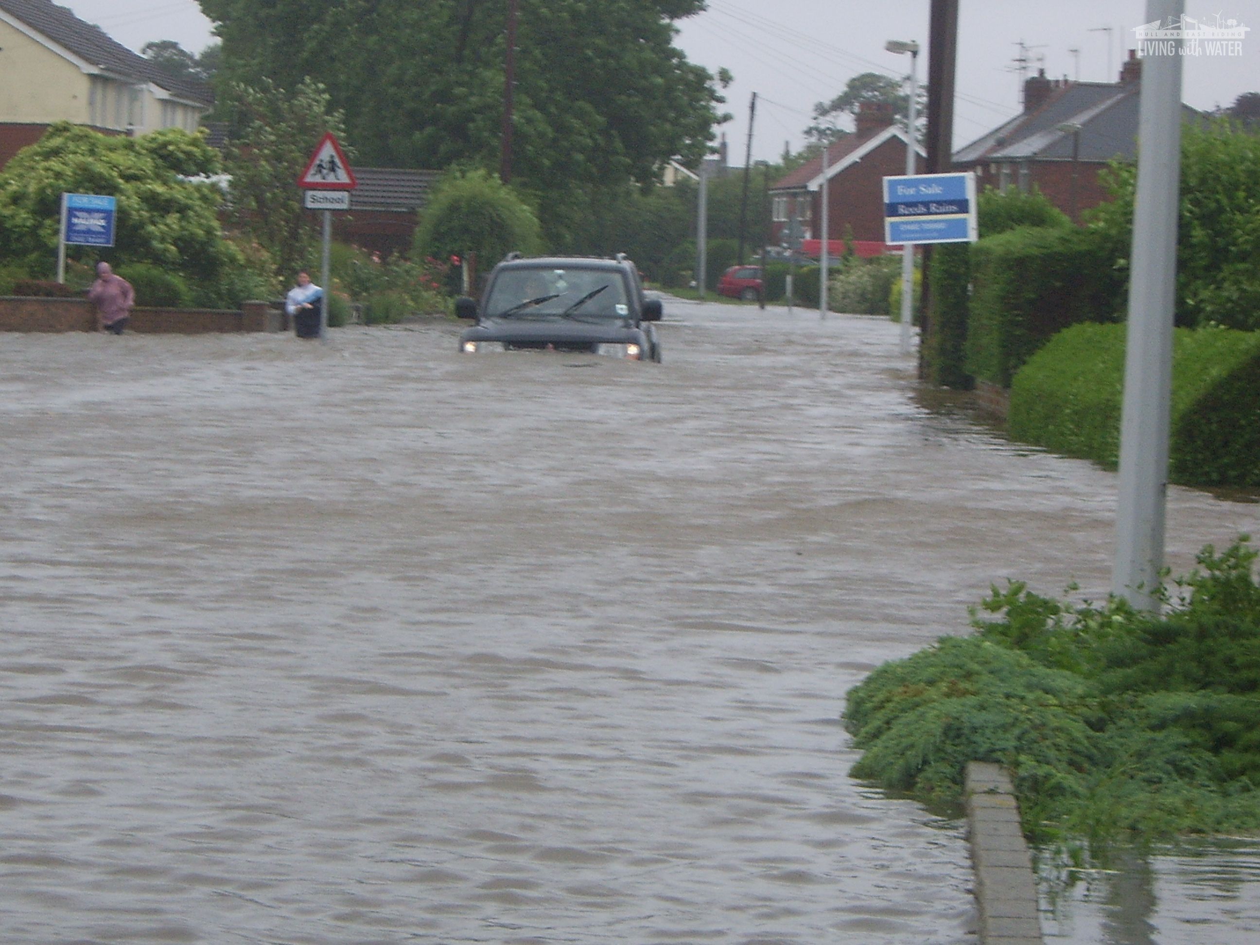
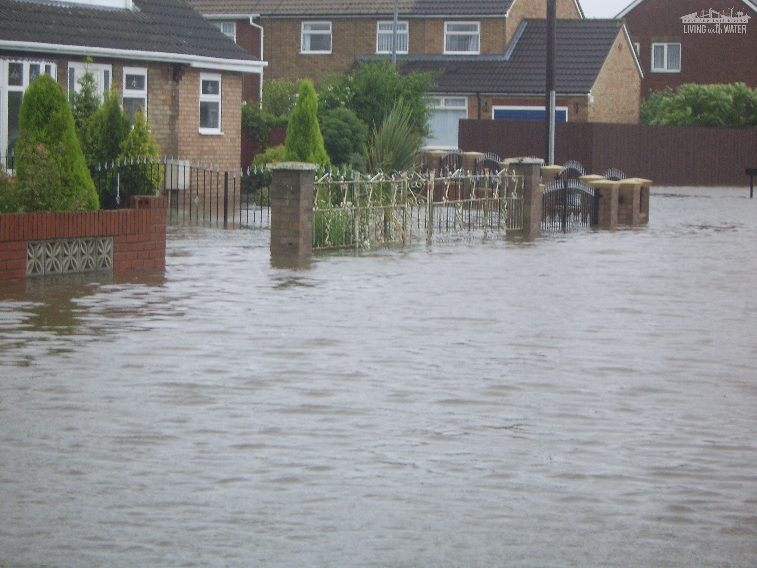
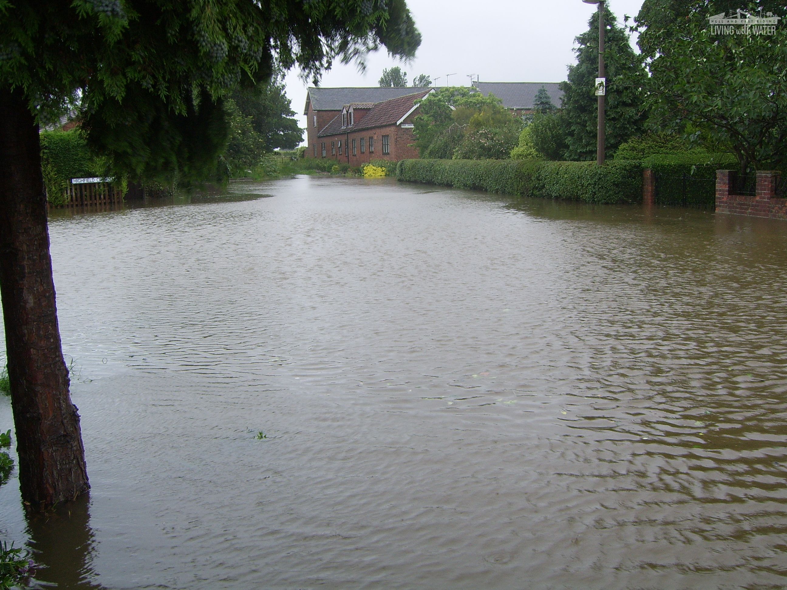
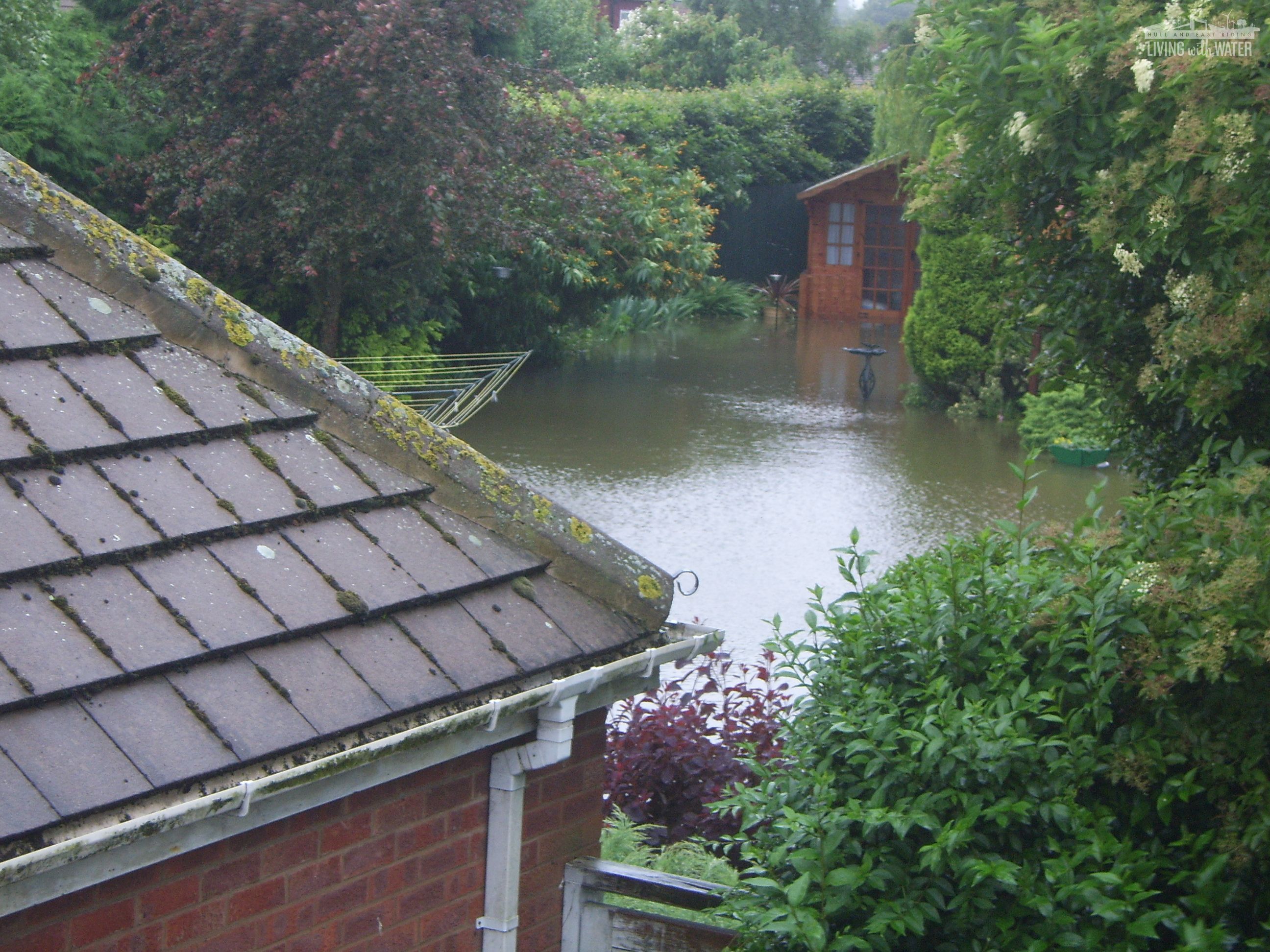
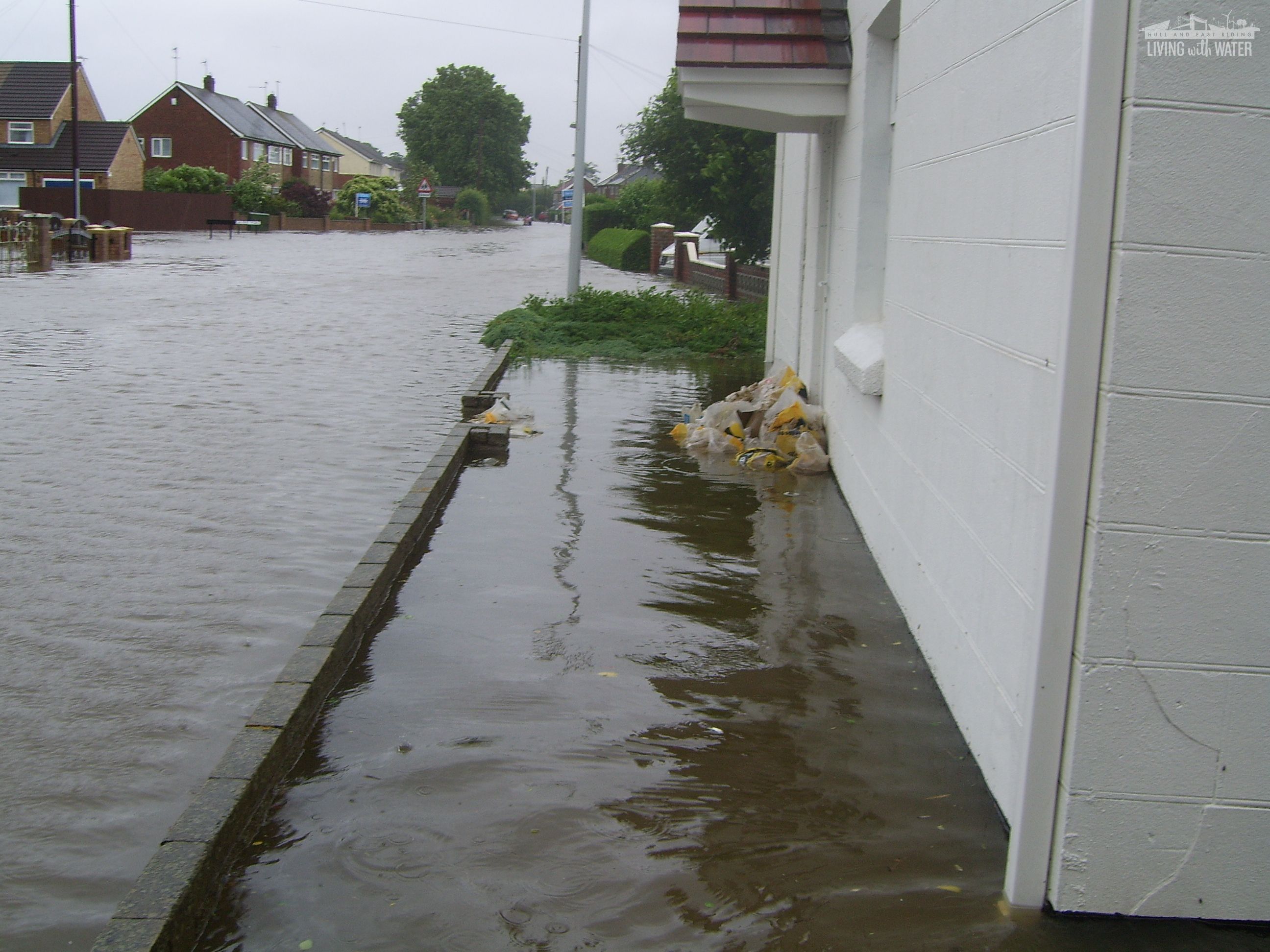
HISTORIC FLOODING IMAGERY – BILTON VILLAGE, 2007
These images reveal the severe nature of flooding which occurred in the village of Bilton during the 2007 floods. The flood schemes we are currently installing around the village aim to mitigate the risk of such an event happening again in future.
Frequently asked questions
Questions from November/December drop-ins
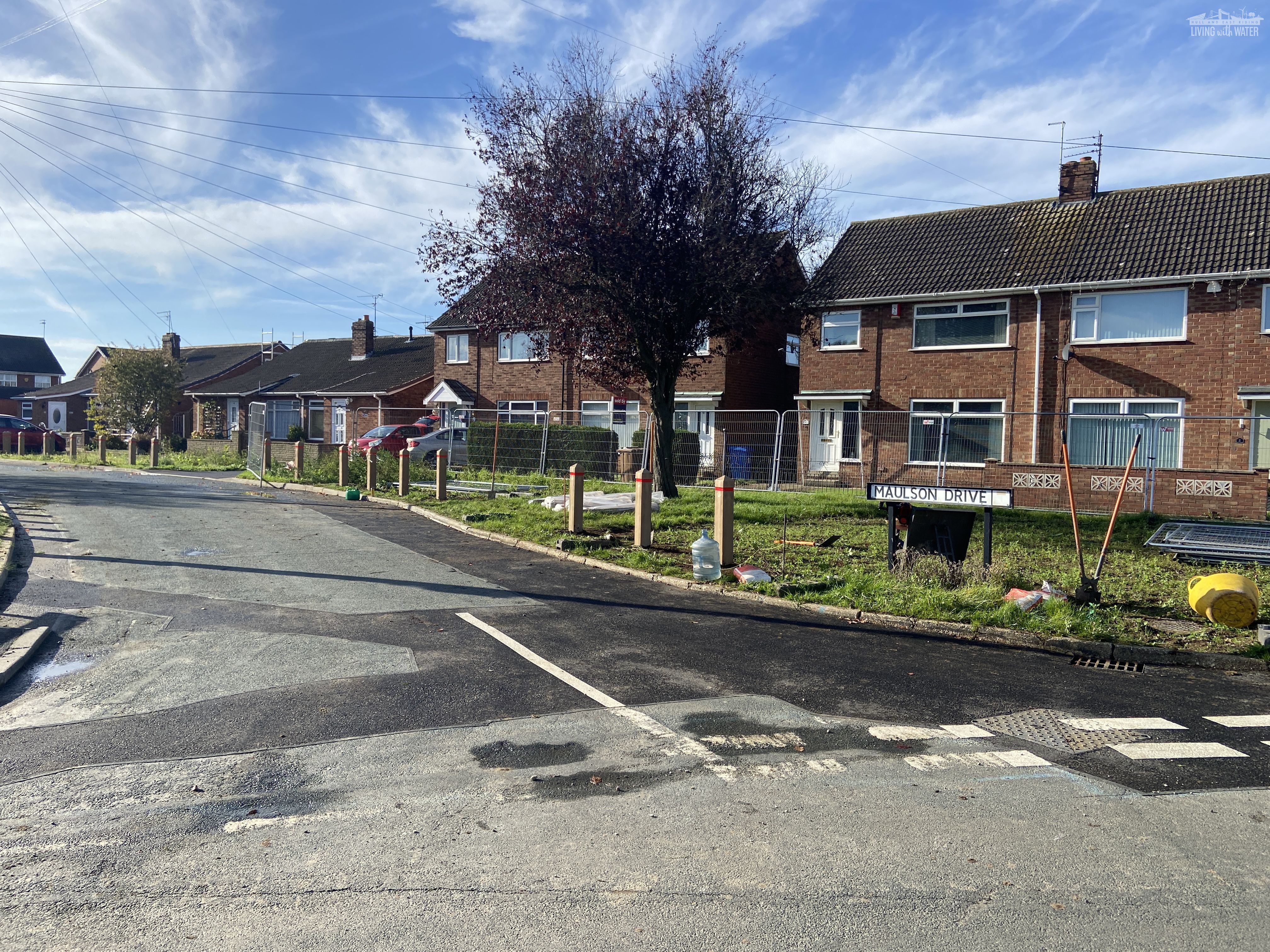
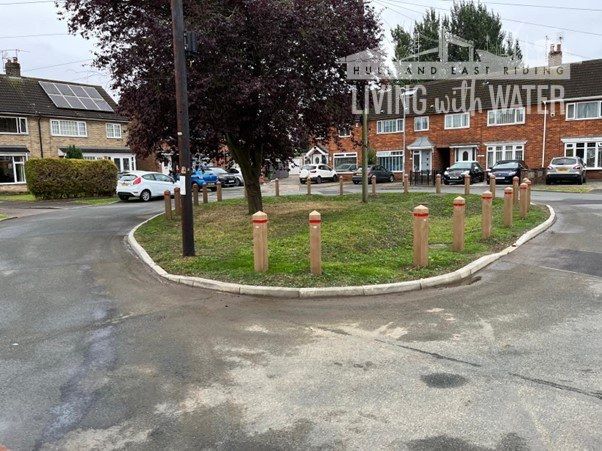
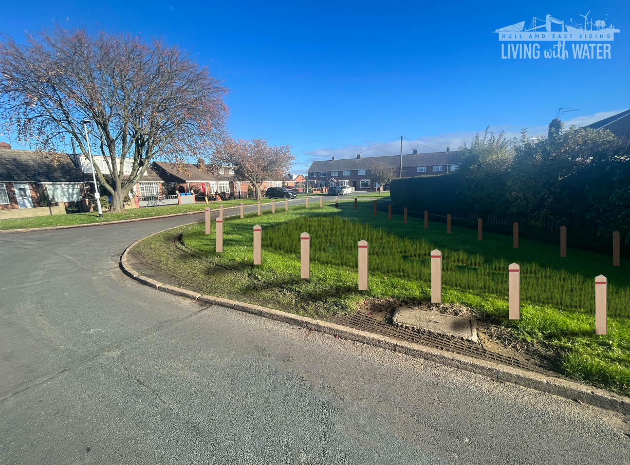
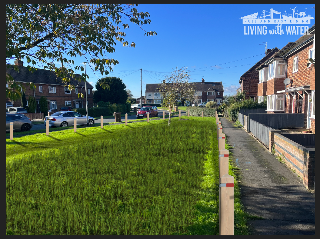
1. The bollards do not match the initial visuals and are unsightly. Can we explore alternative options?
The bollards we installed were chosen to ensure compliance with East Riding of Yorkshire Council’s highway safety criteria, because they include a reflective strip and are constructed using plastic to take impact without causing further risk to pedestrians.
We held a successful walk over in Bilton on Monday 16th December with partners and Councillors exploring all potential solutions. We've taken away the community feedback and instructions from ERYC highways and will feed this back to residents at our next community drop-in.
2. The bollards prevent wheelchair access, people cannot open their car doors as bollards are in the way. Why is this?
Bollards are designed to balance accessibility and protection of public spaces. Regarding disability and wheelchair access, the placement of bollards includes sufficient spacing to allow free passage for wheelchairs, mobility scooters, and pedestrians. Drivers typically have enough space to open their doors fully when parking correctly in designated areas. If individuals are struggling due to specific bollard placements, they can readjust their vehicle for sufficient space to open their door.
3. The wildflower mix used looks untidy and we are concerned about maintenance.
After significant feedback regarding concerns over the use of wildflower mix, we held a formal consultation on the matter in February 2025. The consultation was sent out to streets where we are constructing SuDS. The result of this was 83% in favour of re-seeding areas with grass, and only 17% in favour of wildflowers. As promised at our previous drop-in events, we are therefore honouring this result and removing the wildflowers.
4. What are you doing to prevent risk to children with deep depressions in bioretention areas?
In line with all SuDS installations across the UK, we will ensure that where applicable notices will be installed informing residents of the danger during any short period of water attenuation that occurs.
5. I believe your contractors are casing pooling to occur in the highway which wasn’t there before. Will this be fixed?
We are working with East Riding of Yorkshire Council’s highways department to inspect all paths and pavements around our schemes to ensure that no detriment has been caused as a result of our works.
6. Why has a tree been removed?
Removing trees is unfortunately sometimes necessary due to the proximity of any roots to our schemes and the risks this poses. For any trees that have been sacrificed for the flood scheme, we have planted three in their place - some of which can be found at Bilton Primary School. We have worked closely with students and teachers to ensure these trees provide further flood resilience alongside our critical surface water flood infrastructure.
7. What if an emergency service vehicle needs to access my street and cannot do so due to the bollards?
We consulted with emergency services prior to the scheme to ensure ease of access would be maintained. The bollards are designed with sufficient spacing to allow pedestrian access, which can accommodate personnel on foot. Emergency vehicles generally approach from the road, not directly across grass areas, and bollards ensure vehicle access remains clear where needed, such as at designated driveways or entry points. This setup preserves safety without compromising emergency response.
8. The bin lorry is going over the corner of the pavement on Hungerhills. Will this pose a threat to the flood scheme?
The design of the flood scheme was altered to take into account these concerns, and therefore this now does not pose a risk to the flood assets in the ground. East Riding of Yorkshire are a Living with Water partner, therefore we work very closely together, and they are aware of the scheme and the importance it brings in providing resilience to Bilton.
9. How are you advertising your engagement events, as many of us were not aware they were occurring?
We have held five consultation events so far in the duration of the Bilton scheme, and have more planned. We continually promote our engagement events across all of our schemes using our social media platforms. For our upcoming event on 5th March, a letter has been sent out, which we have also forwarded on to local councillors to ensure they are kept updated. We are also exploring the possibility of using noticeboards in the village. We also try to be present at Parish Council meetings, where invited, and try to ensure that councillors are kept updated on the scheme.
10. Galfrid Road didn’t flood in 2007 so why does it need a flood alleviation measure?
Whilst not all areas of Galfrid Road experienced property flooding (as noted by residents), some areas did flood and adjacent streets witnessed significant flooding - for example along Lime Tree Road and the eastern end of Galfrid Road where it meets Main Road. This would impact residents even if their property was not directly flooded by preventing access to their properties and potentially damaging highways and utilities infrastructure.
11. What will you do about vehicles driving on the flood schemes?
We are working with the Council and will try to engage with those individuals who choose to drive on, and therefore damage, the infrastructure. However, to protect this asset, bollards are in place.
12. What topsoil are you using and where is it from?
The topsoil we are using is that which was excavated from the site and is now being put back, so any debris there was already present originally. We will look into the possibility of hand-picking debris out before it is returned to the ground.
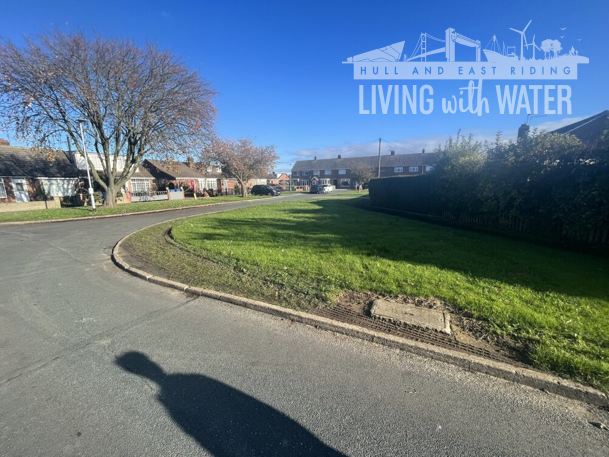
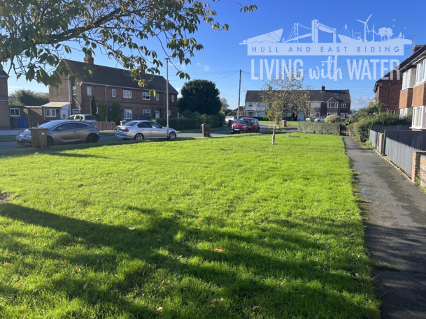
13. Why do the schemes look different to the original artistic impressions?
Artistic impressions are, as they state, impressions of an area or scheme subject to formal conditions being met by all partners working on the scheme. We will work to ensure that any future visualisations look as close to the end product as possible.
14. Can you share the hydraulic model?
The hydraulic modelling is not something we can share with the community as it contains sensitive information pertaining to various assets which are part of the critical infrastructure that manages water across the county.
15. What will happen to our homes, as they are going down in value?
Whilst we are sorry that residents believe this to be the case, with other natural flood schemes across the country, we do not see a negative market trend in price market index.
Questions from previous customer sessions
1. When would the work start and what is taking place currently in my area?
We are finalising the first package of work at Bilton in Beech Ave, Highfield Crescent, Hungerhills Drive & Maulson Drive. The majority of these works have been completed and there are only snagging and planting works still to complete.
Phase two in Galfrid, Quilter, Ravenspur are underway with a completion date of early spring 2025.
2. Will there be any disruptions to traffic routes?
There is a road traffic diversion planned for Ravenspur and Dawnay as we install safely the drainage elements to take surface water run off from the road during peak storm events. We hope to start this on 6th January for approx 6 weeks.
3. How long will the work take?
The timescales for the duration of the work are underway and hope to complete subject to the winter weather conditions early spring 2025. Updates have been sent via letter to affected residents.
4. Will it affect my parking?
We appreciate that working in the highway may reduce some parking spaces but hope to keep that to a minimum.
5. Will it affect playgrounds and recreational areas?
We are looking to utilise areas such as large playing fields as detention basins so that they can be used to store excess water during a heavy rainfall event. When there is a normal level or no rainfall then the areas can be used as normal.
6. Why are you not doing something in the north of the village to mitigate run off from the fields?
East Riding of Yorkshire Council (ERYC) has developed a comprehensive scheme to implement a series of flood defences. This includes addressing the flood risk from north end of Bilton. Securing the necessary funding for this project is a complex and time-intensive process, but we are actively working through it.
The Outline Business Case for the proposed scheme has already received technical assurance approval from the Environment Agency, and development will begin as soon as funding is confirmed. We understand that this is a lengthy process, and we appreciate your patience as we work towards a solution that will benefit the community in the long term.
Subject to planning approval and technical consents it is anticipated that the scheme will be completed by 2028.
7. Why are you not clearing the culvert out at the top of Limetree Lane?
Culverts are not assets of the council or Yorkshire Water they are riparian owner’s responsibility to maintain their section of the culvert. We cannot intervene with private assets and therefore this is not in the scope of the works.
8. Why have you chopped the tree down at Beech Avenue?
To provide maximum flood storage within the green spaces, some trees have been cut down. For every tree we have to sacrifice, we have planted another 3 in close proximity. For the tree we cut down on Beech Avenue, we have planted 3 in the grounds of Bilton Community Primary School.
During the winter months trees are dormant and so do not provide flood resilience.
9. Why are bollards going up everywhere and causing restrictions to emergency services?
Bollards are there to protect the flood assets. We have had instances of residents driving on these assets which can damage beyond repair any benefit we have built into the drainage system. These bollards meet a specific East Riding of Yorkshire highway specification, so adhere to those requirements.
Liaising with all blue light services we have been re-assured that these do not cause any restrictions to get to an emergency incident.
10. Why are we using beany blocks on Galfrid Rd that look like they belong on a motorway they are that big?
The beany blocks allow us the opportunity to collect and convey rainwater runoff to the various SuDS, rather than use gullies and buried pipework and re-grading of the existing road surfaces. In addition, the beany blocks are shallow and enable gravity flows to discharge to the existing sewerage, avoiding the need for costly and impractical pumping stations.
11. What is surface water flooding?
Surface water flooding happens when rainwater does not drain away through the normal drainage systems or soak into the ground, but lies on or flows over the ground instead, causing potential risks of flooding to properties. (GOVUK)
12. How full of water will the aquagreens get?
At times of very hard rainfall over a prolonged period the basins will fill with water as per the design and up to a depth of 450mm. The chances of children playing in them when the rain is so hard and prolonged is low. The basins provide storage to reduce the risk of flooding in the street and people’s properties so flooding will be in a controlled manner, in areas that are designed to flood. The scheme also intends to be educational and for people to understand how rainfall runoff is collected and conveyed, how drainage works and how to live with it.
We will be installing notice boards informing residents more on the aqua greens once complete.
13. Who is responsible for the scheme?
The scheme will be a Living with Water scheme, meaning the parties involved in the Partnership (Yorkshire Water, Hull City Council, Environment Agency, East Riding of Yorkshire Council) will be responsible for parts of or all of the works.
14. Will it cost me any money?
The scheme will not cost the resident any money. It is funded through the Living with Water Partnership which in turn has received money from the government to put in place schemes to provide blue and green infrastructure in Hull to mitigate flooding.
15. Will you need to come into my home?
Should we look to disconnect the rain pipes from houses, there may be a request to come into or close to your property. We will at all times, write to you in advance and ensure all personnel visiting the property have the relevant ID badges and paperwork.
16. How can I contact Living with Water if I have an issue or query?
You can get in touch by emailing us at enquiries@livingwithwater.co.uk. We also have an upcoming community drop-in on 5th March 2025 to allow residents to pop along, ask questions, and receive updates (where applicable). We also post updates and useful information on our social media channels - just search 'Living with Water' on Facebook or LinkedIn.
We are very keen to come and talk to residents, so if you run a community group, event or activity and have space for us to consult with residents on our plans, please get in touch by emailing enquiries@livingwithwater.co.uk

