System thinking connects LWW's requirements and potential with roadways, housing, parks, and asset management on our 25 year blue green plan.
Hull and Haltemprice are set within a bowl-shaped zone with sloping topography leading to a flat, urban area. This basin-like landscape causes rainwater to collect, triggering regular flooding. Since devastating floods in 2007, there has been significant investment to reduce these incidents. However, to create true flood resilience and prepare and adapt to climate change, a collaborative, long-term vision was required.
This plan required comprehensive consultation to get an accurate picture of the current and future needs of the community. This involved collaboration between The Environment Agency, local councils, community members, Yorkshire Water, academics, and experts across a wide variety of specialisms. The Living with Waters principle engineers, Stantec, supported the research phase, employing a range of digital engagement and analysis tools and technology.
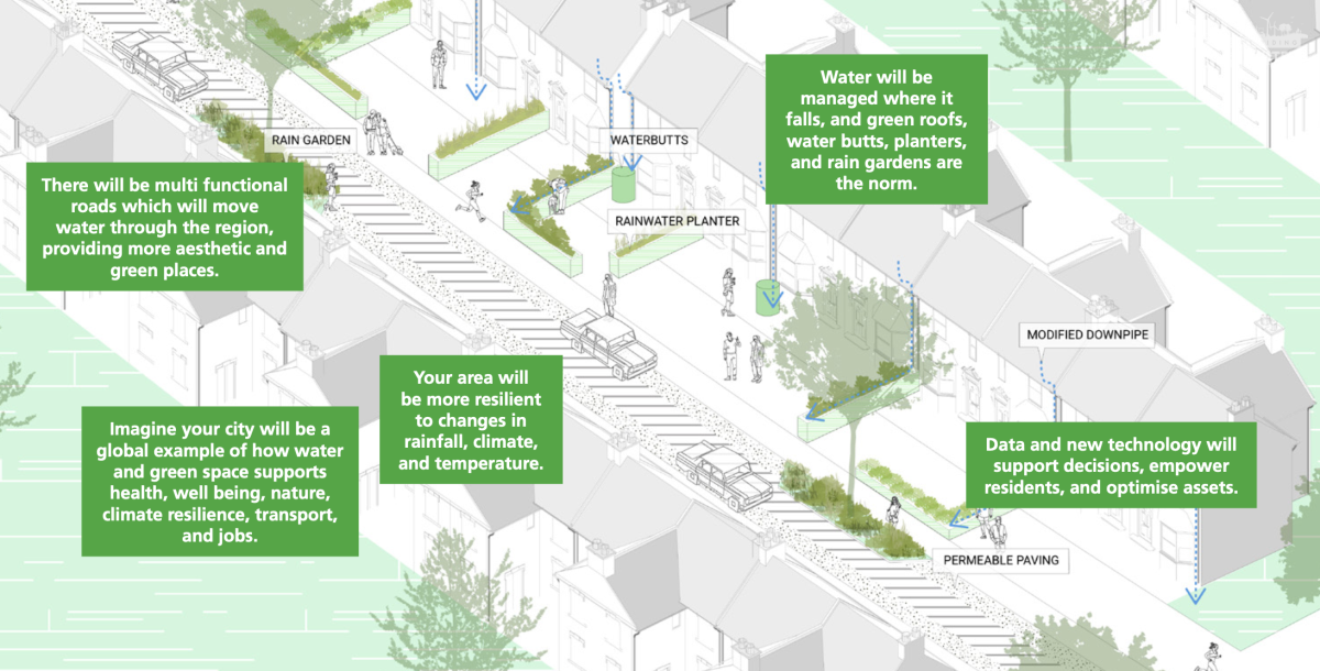
We have developed flood resilience and innovative water management methods. Focusing on prioritising blue-green infrastructure (BGI)—nature-based solutions and sustainable drainage systems (SuDS) can create better places to live and work while preventing future flooding—the plan includes smart drainage system control and action guidance. How we manage change in the future will increase opportunities creation and create a blue-green resilient city with people and culture being imperative to the strategy.
To find out more about our Blue Green plan, click the PDF link below.